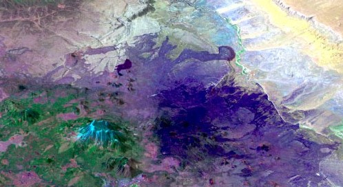
Welcome to the Arizona Satellite 3D website. This site consists of QuickTime Virtual Reality (QTVR) movies of satellite images draped over digital topography for each 1° X 1° quadrangle in Arizona. Each movie consists of a 3D perspective of the quadrangle that the user can rotate to view the area from any direction. This site allows you to observe the distribution of different rock types, vegetation, and soils, all of which are reflected in the satellite images.
To use this site you will need QuickTime installed on your computer, either as a plug-in for your browser or as a stand-alone application to run downloaded files. To access a movie, click on the link below to jump to a page with a shaded relief index map of Arizona. Once this map is displayed, clicking on any of the 1° X 1° squares will bring up the QTVR movie for that area. Alternatively, you can download the file to your computer and run QuickTime as an application separate from your browser. To rotate the movie, click and drag your mouse to either the left or the right, or use the left and right curser keys Most movies are 2 to 3 Mb and require some time to download on slow Internet connections.
AZ Sat 3D Info: Sources of data and how Arizona Sat 3D was developed.
AZ Geo 3D: A website similar to AZ Satellite 3D, but with the geologic map of Arizona draped over digital topography for each 1 X 1 degree quadrangle in Arizona.
AZ Topo 3D: A website similar to AZ Satellite 3D, but with topographic maps draped over digital topography for each 1 X 1 degree quadrangle in Arizona.
AZGeoTopoSat3D: A related website enabling users to compare satellite, topographic, and geologic information for each 1 X 1 degree quadrangle in Arizona.
Arizona Geology Virtual Tourist: Click your way through Arizona scenery. See what the actual landscapes look like for the same areas as in Arizona Geology 3D.
Arizona Geologic Map Interactive: A zoomable version of the 1988 Geologic Map of Arizona, with photos of map units for the geologic map used in Arizona Geology 3D.
To obtain a free copy of QuickTime, click here.
© Copyright 2001, 2002, 2003 by Stephen J. Reynolds, Joshua A. Coyan, and Julia K. Johnson. These images can be freely used for educational purposes as long as the source is cited.