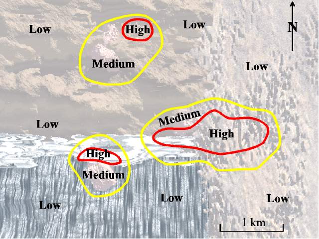
This map shows the results of an electrical survey done by a team of geophysicists (geologists who study the Earth by measuring gravity, magnetism, seismic waves, and electrical properties of rocks). The map was derived by putting electrical current into the ground via a portable electrical transmitter. An electrical receiver, placed in the ground several hundred feet away from the transmitter, measures how much current comes through the ground. If lots of current makes it from the transmitter to the receiver, the intervening rocks are highly conductive. Rocks can be highly conductive if they contain lots of conductive minerals, like the sulfide minerals pyrite (iron sulfide, also known as "fools gold") and chalcocite (copper sulfide), both of which can be associated with major copper deposits. Some minerals, like clay, are also conductive and can be misinterpreted as sulfide minerals on electrical maps. Increasing the spacing between the transmitter and receiver lets the current go deeper into the ground and permits measuring conductivities of deeper rocks. Such electrical surveys, therefore, are good at identifying a "hidden" deposit that is not exposed at the surface because it is buried beneath a thin layer of overlying rocks.