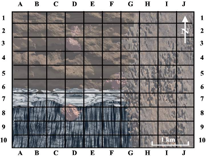
This grid shows the possible locations of exploration drill holes. A drill hole is ordered by its grid number, such as J-10 for the square in the lower right corner. For each drill hole, you will receive a drilling log that shows the rock types and type of ore encountered (dark shading = High grade; medium shading = M grade; light shading = low grade; none for no ore). "Ore points" are earned according to the following key: H - 4 pts, M - 2 pts, and L - 1 pt. Ten points in contiguous squares (must be touching on a side, not just a corner) are needed to define an economic mine (this makes your open pit smaller and more economic). Some drill holes also contain deep medium-grade ore, worth one bonus point, if you already have ten points from your shallow ore. This is how it really works, with companies being able to mine the deeper ore if they have the mill and other facilities paid for by shallow ore. Use this map to keep track of ore grades (high, medium, low, or none) in each grid drilled. Since drill holes are very expensive, choose your site carefully.