Every fifth line on a
topographic map is an index contour and has
its elevation labeled. On this map, the 2500 contour line is darker
because it is an index contour. The 2400 and 2600
contours are also
darker.![]()
|
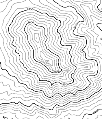
The lines on these maps are called contour
lines. They
connect points of equal elevation. If you were to travel along one
of these lines, you would stay at the same height above sea level. Every fifth line on a
topographic map is an index contour and has
its elevation labeled. On this map, the 2500 contour line is darker
because it is an index contour. The 2400 and 2600
contours are also
darker. |
||
| Contours | |||