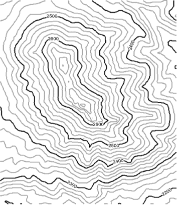
Here is an example of how you might describe flooding of this landscape. How does this compare to your verbal description?
Flooding begins at the bottom of the map, followed by water moving in from the top right. When the water rises high enough, it completely surrounds the upper part of the hill. The peak toward the front of the hill is the highest point on the map and floods last.