Rock sample 1
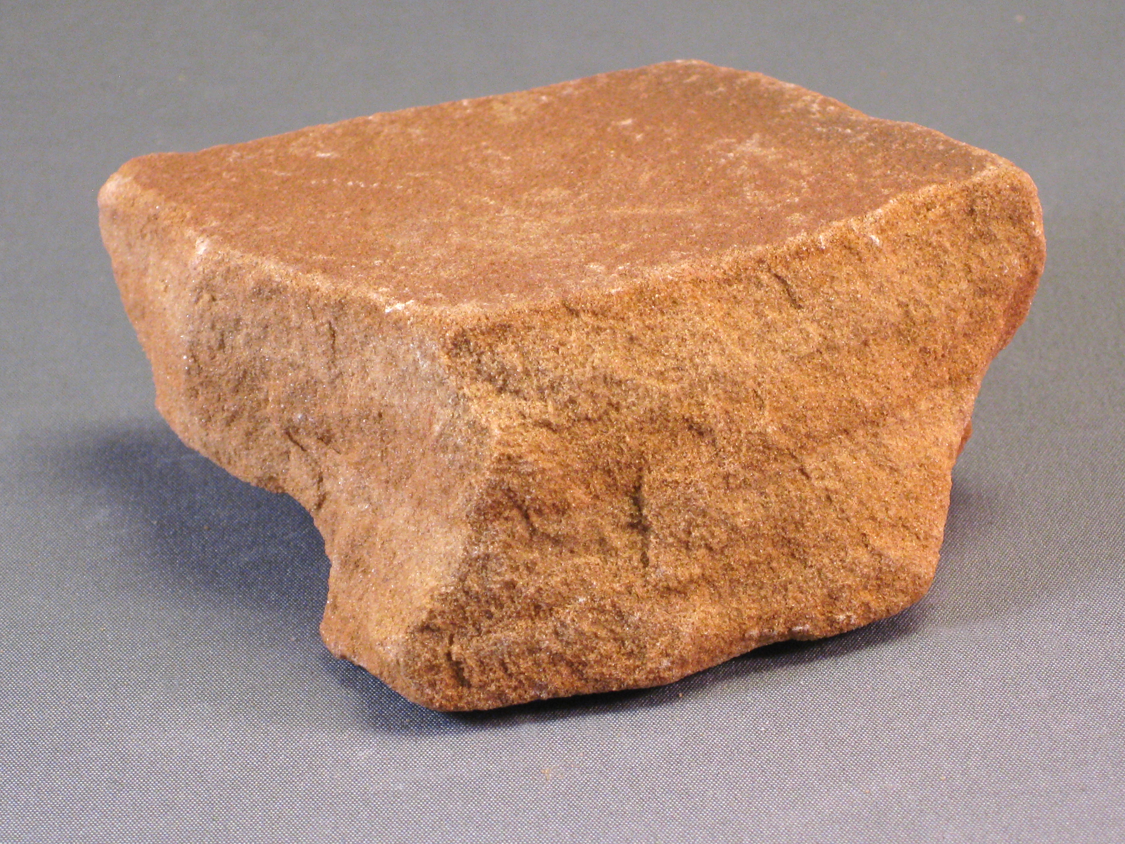
Rock sample 2

Hint: this rock reacts with
hydrochloric acid
Rock sample 3

Rock sample 4

The photographs below show sedimentary rocks from the Grand Canyon. Follow the directions in your lab manual to observe, describe, and name each rock sample in Worksheet 10B in your lab manual. A single rock type (e.g., sandstone) may be present more than once in the collection, with the different samples having slight differences in appearance (e.g., white sandstone versus red sandstone).
NOTE: There is a Hints Sheet in the lab manual that will help with several aspects of this exercise, especially reconstructing the geologic history.
Click on the thumbnail images below to view larger photographs.
Rock sample 1
|
Rock sample 2
Hint: this rock reacts with |
Rock sample 3
|
Rock sample 4
|
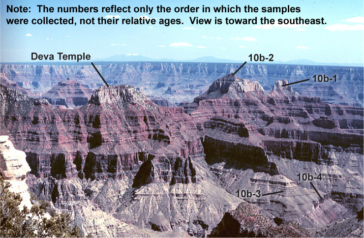
The color photograph below shows the geologic section from which the above rock samples were taken. Follow the directions in your lab manual to arrange the rock samples in order from youngest to oldest, using the photograph below as a guide.
The link below leads to a geologic map of the Grand Canyon. Follow the directions in your lab manual and use the Grand Canyon geologic map to determine which geologic unit (e.g., Kaibab Limestone) your sample represents.
Geologic map of the Grand Canyon
If you are interested in observing the geology of the Grand Canyon in Google Earth, click here to download the .kmz file. You will need to have Google Earth installed on your device to view this file. Also, make sure your device is configured so that Google Earth is the default application to open kmz files (otherwise, simply download the file, open Google Earth, and in Google Earth browse to open the file).
After you have completed Exercise 10B as described in your lab manual, complete Assessment 10B on Canvas.