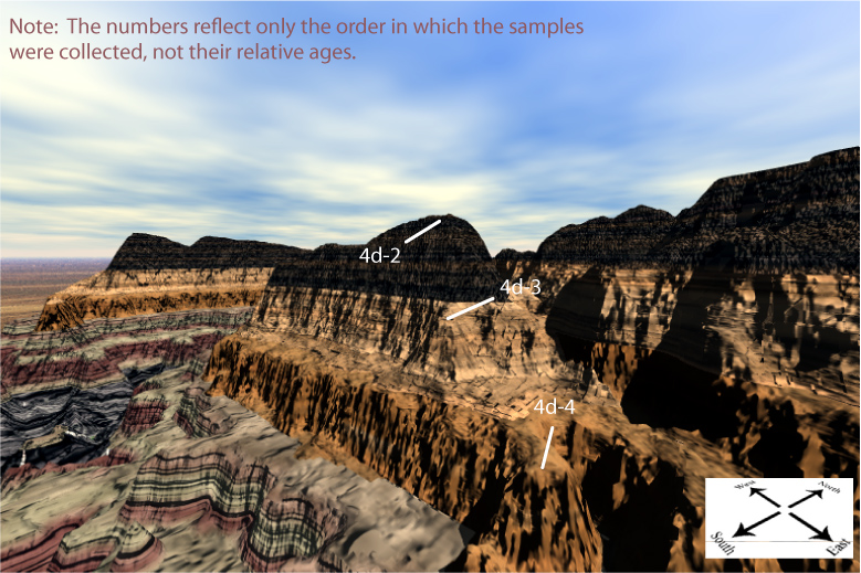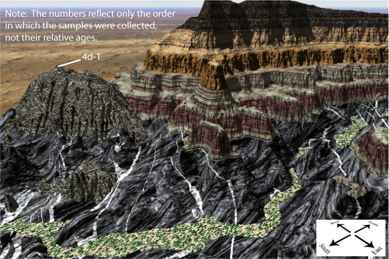
Below are 3D perspectives of five sample collection sites from Painted Canyon. Note the geologic setting of each sample site, such as the geologic layer or unit from which it was collected (you will want to understand this in a later lab).
Follow the directions provided in your lab manual to complete Exercise 4D. Then, complete Assessment 4D in Canvas.
NOTE: When you do this exercise in Canvas, you will click on areas of the Painted Canyon topographic map to indicate the location of sample sites. So take the time to look at the image below and plot each sample location on your map now, before you start the exercise in Canvas. You will have three chances to click on the correct area for each sample.
The view is toward the northwest, and you are not seeing all of the map.
This view is toward the west from the east edge of the map area, and you are not seeing all the map. It shows the south-facing cliffs in the east-central part of the map (1,000 meters north of the south edge of the map)