Rock sample 1
Hint: this sedimentary rock reacts
with hydrochloric acid
Rock sample 2
Hint: this is an igneous rock
Rock sample 3
Hint: this is an igneous rock,
not slate (a metamorphic rock)
Examine the photographs below, which show photographs of several rock samples from the area of SP Crater. Examine and identify each rock type, entering your information in Worksheet 7A in the lab manual.
Rock sample 1 Hint: this sedimentary rock reacts |
Rock sample 2 Hint: this is an igneous rock |
Rock sample 3 Hint: this is an igneous rock, |
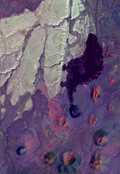
Below is a satellite map of SP Crater. A black and white version of this map is in your lab manual.

Watch the video below, which illustrates how to define boundaries between different rock units and the location of a fault and other geologic features to create a geologic map.
Mapping SP Crater (with closed captioning via MediaAMP)
Mapping SP Crater (without closed captioning)