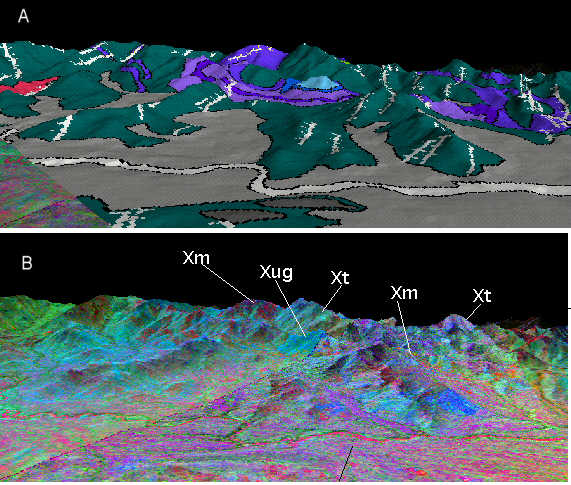
 Figure 15. (a) geologic map
and (b) TIMS image (5-3-1) decorrelation stretch draped over
digital topography, showing the correlation between the imagery
and the rock units. Map symbology same as on geologic map
Figure 15. (a) geologic map
and (b) TIMS image (5-3-1) decorrelation stretch draped over
digital topography, showing the correlation between the imagery
and the rock units. Map symbology same as on geologic map Figure 15. (a) geologic map
and (b) TIMS image (5-3-1) decorrelation stretch draped over
digital topography, showing the correlation between the imagery
and the rock units. Map symbology same as on geologic map
Bedrock Geology Project
Abstract
Overview
Proterozoic rock units
Proterozoic Structures
Remote Sensing techniques
References and
Acknowledgments
Geology and Web pages by Steven Wood and
Stephen J. Reynolds, Dept. of Geology, Arizona State
University, Tempe, AZ -- July 1998