The Gallery of Virtual Topography features virtual depictions of topography, including 3D perspectives and QuickTime Virtual Reality (QTVR) movies, created from Digital Elevation Models (DEM's). The site showcases QTVR object movies where the user can spin a 3D terrain to view it from different perspectives. It also includes static 3D-perspective images (JPEG files) of the 3D terrains for those users with slower Internet connections. Some movies and images depict only the form of the landscape, but in others topographic contours are draped over the landscape to better illustrate the how contours portray different type of topography (cliffs versus badlands, for example). Some animations illustrate the significance of contours, by allowing the user to progressively fill the landscape up with water to and see the water interact with different topographic features. The site also contains a topographic contour map for each 3D terrain, so that instructors can develop student exercises, such as locating points on a map and constructing topographic profiles. Some QTVR movies contain numbered topographic features just for this purpose.
Enter the Gallery of Virtual Topography
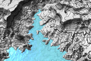
The link below is to a cute little, and I mean little, movie
to see what the bigger ones will be like.
(click and drag the mouse up and down in the movie window)
Tiny Version of QTVR movie of New River Mesa Topography with Water Plane
Visit the Virtual Topography Information Page to see where we got the data, how we constructed the movies, and who helped fund it.
All materials are copyright ©2000 by Stephen J. Reynolds and Julia K. Johnson, but can be used freely for educational, noncommercial uses, as long as the source is cited. If you use the site, tell me, because it's a nice thing to do.
![]() Arizona
Geology 3D -- The Arizona Geology 3D website consists of QuickTime Virtual
Reality (QTVR) movies of the Geologic Map of Arizona draped over digital
topography for each 1° X 1° quadrangle.
Arizona
Geology 3D -- The Arizona Geology 3D website consists of QuickTime Virtual
Reality (QTVR) movies of the Geologic Map of Arizona draped over digital
topography for each 1° X 1° quadrangle.
![]() 3D
Geologic Map Gallery -- QTVR movies and images of classic geologic maps
draped over digital topography
3D
Geologic Map Gallery -- QTVR movies and images of classic geologic maps
draped over digital topography
The Hidden Earth -- Visualizing Subsurface Geology -- These images help students and others visualize subsurface geology. It's part on an NSF-funded project we've begun.
Painted Canyon -- A Geologic Wonderland -- These images, done with Bryce4, are of an imaginary, but representative, Southwestern canyon. They are used in our Intro geology lab. Some of the files are large (not very compressed), especially the cool QTVR panoramas (pivot 360 degrees).
Geologic Scenery Images -- Cool images of how tilted layers interact with topography and more.
Arizona Geology Virtual Tourist -- Click your way through Arizona scenery
Steve Reynolds Home Page -- Lots of other stuff related to geology, Arizona, and geoscience education
Page created by: S. Reynolds